Central Way
Branca < > Santo Estevão
Stage 14
Santo Estevão is a rural commune located 16 km from Benavente (County seat), with a total area of 62.41 km2 and around 2000 inhabitants, according to the 2011 Census. The territory, besides the urban agglomerate, comprises many areas of cultivation and pasture and is located on the right bank of the river Almansor. The site of Foros de Almada, an integral part of the commune, is 5 km from the village. Known over the years not only by the current toponym but also by Santo Estevão da Ribeira and Aldeia de Santo Estevão da Ribeira de Canha, it owes these names to the proximity of the river Almansor also called, at this crossing point, Ribeira de Santo Estevão or Ribeira de Canha.
Several archaeological finds, discovered in the area delimited by the parish, point to the human presence in this region since prehistoric times. However, the earliest reference to this small urban center dates back to the 14th century:The Inventário dos bens móveis e imóveis da Ordem de Avis (Inventory of movable and immovable property of the Order of Avis) dated 1364, refers to the herdades of Ribeira de Canha, among which the following is designated: “Item outra coirela acima de San Stevã que parte cõ Roi Gil e cõ Domingos Bugalho e seus ereos”. Therefore, in this year there was already a chapel with Saint Stephen as a patron, although without certainties on its pastor. In the text of the Torre do Tombo of the same Order, made in 1561, one may conclude that, by this time, the hermitage already had its own pastor and “eighteen patrons”.
Saint Stephen is the patron saint of the parish, which adopted the same toponym. Stephen, a Jewish deacon who spoke Greek, was the first Christian martyr. Excellent preacher, he was the object of great opposition and hostility, being at the end denounced and accused of blasphemy in the Sanhedrin (the supreme assembly of Jerusalem). He was taken out of the city and stoned to death.
The village
A moorland area composed of hills and valleys, some farms and an enviable forest mantle rich in cork oak. But, it’s in its population that lies the greatest wealth. Simple, honest and hardworking people who, for generations, dedicated themselves to work in the fields, on behalf of the considerable agricultural and livestock farms in the region. Monte do Zambujeiro, Monte dos Condes, Monte de Almada, Mata do Duque (Cadaval), Monte da Quinta and Monte do Termo should have a particular highlight. Rich in crop fields mainly of wheat and rice, and pastures dominated by cattle, horses, and pigs. Casa Cadaval, Manuel Luís Anastácio, and Anacleto de Moura were dedicated to the creation of brave cattle, also used in agricultural works.
At the beginning of the 60s of the 20th century, the Equipagem de Santo Huberto (Saint Hubert’s Crew), dedicated to equestrian activities, settled in the village with a particular interest in fox hunting on horseback, with packs of trained dogs. The excellent natural conditions for the exercise of this sport brought to the region many national and foreign practitioners, enthusiasts of this modality.
The village is rich in biodiversity and stands out for the abundance of storks. It is integrated (together with the municipalities of Benavente and Samora Correia) in the Natural Reserve of Tejo’s Estuary, one of the wetlands of excellence for the stationing of migratory birds from Europe.Over the years, the people of Santo Estevão have always been party lovers, whether it is religious or profane. The processions in honor of Our Lady of Conception and Saint Stephen, patron saint of the parish, outstand. The annual calendar is generous in cultural, sporting and recreational activities, which involve not only its inhabitants but many visitors from the nearest localities.The municipality is equipped with several collective facilities, namely: a community meeting house, a daycare center for the elderly with home support, a gymnastic sports pavilion, a kindergarten, pre-school and 1st Cycle, among others.
Parisch Church
Overlooking the river Almansor (also known as Ribeira de Santo Estêvão), the Parish Church must have its origins in the 14th century, when the locality is mentioned for the first time. In the 18th century, the parish priest was a member of the Order of São Bento de Avis (St Benedict of Avis), an institution that held rights over the locality since, at least, the 16th century. The church is a simple temple of a single nave that evokes the antiquity and relevance of the locality in this interior territory stretch.
and also…
Santo Estêvão Festivities − August
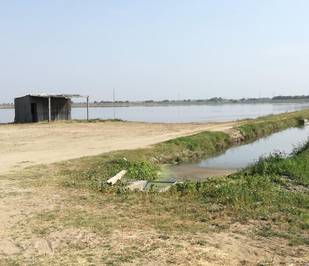
Special Protection Area for the Birdlife of Ribeira de Santo Estevão
Covering the entire river valley, which includes the Site of Ornithological Interest, the Special Protection Area for the Birdlife of Ribeira de Santo Estevão is an area of alluvial soils, occupied by rice fields, a network of channels skirted by tábua, surrounded by an area covered with cork oak, together with meadow pine. There also subsists a small palustrine area of the paul type, composed of a dense patch of willows and tábua. Vulnerable biotope (paul), important feeding area for Limosa limosa during winter (rice fields).
Some important agricultural properties are located on this moorland in Coruche, where the origin of the most Portuguese dish, Cozido à Portuguesa, is legitimately claimed. A place where different cabbages, sausages and vegetables are produced, the ingredients of this wonderful stew. At the end we can’t forgetting the typical desert Arroz Doce (sweet rice).
From the asphalt of Estrada dos Alemães, we head to Branca’s exit. After 3.5 km, the road bifurcates and becomes now a sandy macadam, which we follow in the right lane. Over the next 7 km, large enclosed estates succeed each other on both sides of the road, with extensive forestry explorations of little landscape interest. The route can become a bit tedious, but the fire prevention and traveler’s safety require it.500 m before we reach the N119 road, we turn left and proceed, still by macadam, until we enter into Mata do Duque forest, where luxurious villas have been installed. At the end of the road, we turn right to the tarmac road, and further on we cross the N119, next to Almansor riverbed. After 1.3 km, through the cultivated moorland and pastures, we come across Lusitano crossbreed horses, from Herdade do Zambujeiro. In the Coudelaria António Guerriero’s equestrian training center, there are coupling classes with sport horses.
We follow 2,7 km till the center of Santo Estêvão civil parish, near the municipal market. The name of this locality comes from the first Christian martyr, the Jewish deacon Stephen. With convicted opinions and attempts to convert to Christianity, he was accused of blasphemy and sentenced to a violent death, just outside the village.
Full of history and traces of ancient defensive fortifications, possibly from Roman times, this village belonged to the Order of Avis in the 16th century. As usual, we go to the local parish council in order to collect the necessary information for our stay.
Tips
Always carry water, supplies, sunscreen, a hat, waterproof, comfortable shoes, and a map.
Support
 CTT Post Office
![]() Bank/Cash Dispenser
Bank/Cash Dispenser
![]() Supermarket
Supermarket
![]() Santo Estêvão +351 917 323 679
Santo Estêvão +351 917 323 679
Where to Sleep
![]() Monte de São José
Monte de São José
![]() Hospedaria
Hospedaria
![]() Monte dos Duques Hotel
Monte dos Duques Hotel
Public Entities
![]() Santo Estêvão Parish Council
Santo Estêvão Parish Council
+351 263 949 216
Health
![]() Pharmacy
Pharmacy
Points of Interest
 Santo Estêvão Church
 Santo Estêvão Village
![]() Ribeira de Santo Estêvão Special Protection Area for the Birds
Ribeira de Santo Estêvão Special Protection Area for the Birds
USEFUL CONTACTS
Emergency: 112
Forest Fires: 117
Benavente Fire Department(Santo Estêvão section): +351 263 516 122
CODE OF CONDUCT
Do not leave the marked and signaled route. Do not approach cliffs. Pay attention to the markings. Do not dispose of organic or inorganic waste during the trail, take a bag for this purpose. If you see garbage, collect it, help us to keep the Paths clean. Beware of livestock, don’t bother the animals. Leave Nature intact. Do not collect plants, animals or rocks. Avoid making noise. Respect private property, close gates and barriers. Don’t light fires and be careful with cigarettes. Do not vandalize the Paths signage.